Responding to messages: The Sky Islands and vibrancy of Southwestern deserts
(Originally posted elsewhere on 19 December 2019.)
Thank you for the response (for those following again, it was in response to discussion of wastelanding, Spanish/Mexican/US conquest, the notion that the deserts of North America are vibrant, and reptile endemism).
Yep, sure.
Regarding the high biodiversity and endemic distribution range in the deserts of Turtle Island's "Southwest."
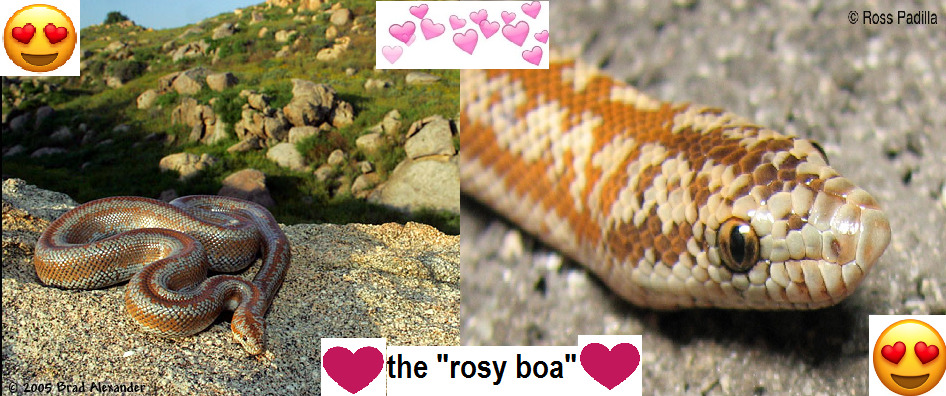
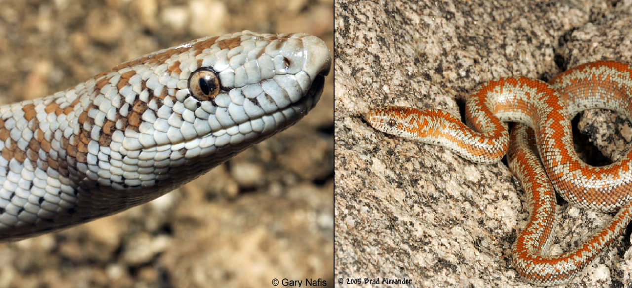
I made this recently:
Anyway:
Just to situate the place first:
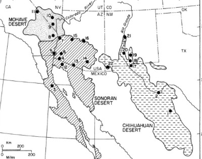
The 3 “true deserts” or “hot deserts” in the region are the Chihuahuan Desert; Sonoran Desert; and Mojave Desert. [This map is a little outdated; the Mojave actually clearly extends into the southwestern corner of Utah, for example.]
And the 3-ish most prominent “cold deserts” or “semideserts” are the Great Basin Desert; Colorado Plateau; and Arizona-New Mexico Plateau. [Map from HARC, using the WWF’s and EPA’s ecoregion standards, which I generally think are pretty good.]
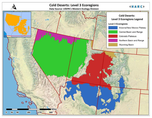
Disclaimer: “Great Basin Desert” is more like semiarid steppe; it receives more moisture in the form of snow, and it’s also characterized mostly by sagebrush steppe, though saltbrush and Lahontan sand playas are also widespread. But, basically, it is contiguous with the nearby true deserts. Also, I personally think it’s useful to split the Great Basin into 2 general regions: (1) the really “desert-y” portion is the Great Basin Desert ecoregion displayed on the map here in green as “Central Basin and Range”, which hosts the majority of saltbrush and salt playas; and (2) then there’s the “northern Great Basin” of the Columbia Plateau and Columbia River watershed (Oregon High Desert and southern Idaho), which is relatively less “desert-y.” Anyway.
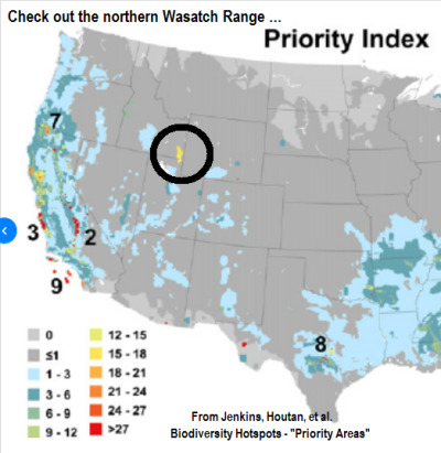
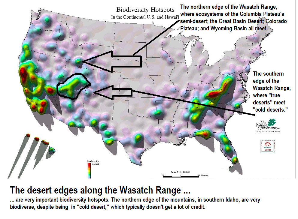
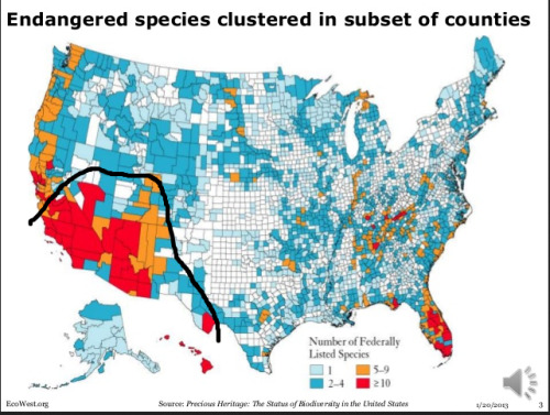
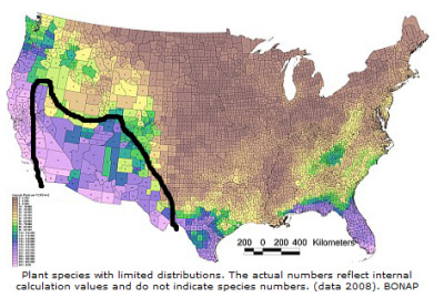
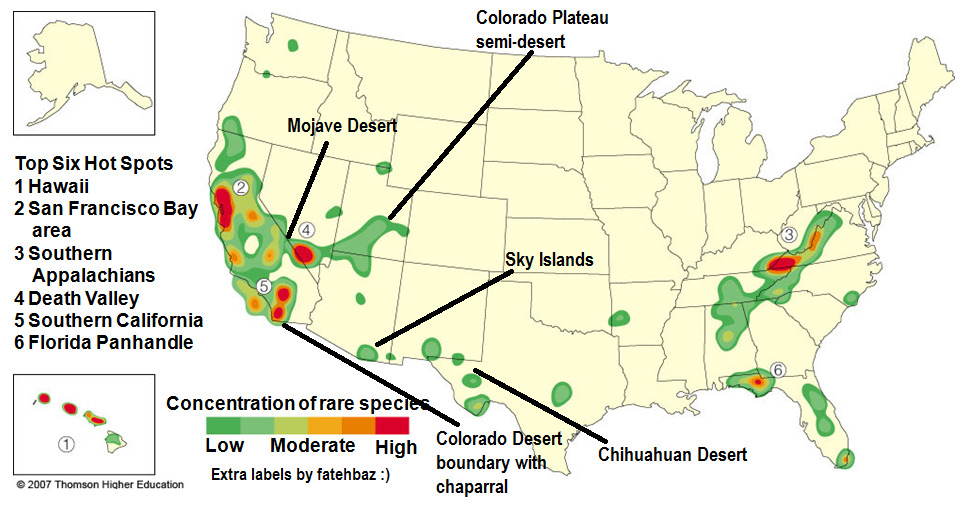
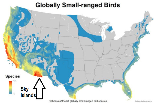
Here’s a look at the Mojave Desert as one of the most prominent regions of concentrated “rare” species. The (1) Colorado Desert; (2) the boundary between the Wasatch Range and the “semi-desert” of the Colorado Plateau; (3) the Sky Islands; and (4) the Chihuahuan Desert also host concentrations of globally-rare small-range species. [From Thom/son Higher Education.]
Disclaimer: “Great Basin Desert” is more like semiarid steppe; it receives more moisture in the form of snow, and it’s also characterized mostly by sagebrush steppe, though saltbrush and Lahontan sand playas are also widespread. But, basically, it is contiguous with the nearby true deserts. Also, I personally think it’s useful to split the Great Basin into 2 general regions: (1) the really “desert-y” portion is the Great Basin Desert ecoregion displayed on the map here in green as “Central Basin and Range”, which hosts the majority of saltbrush and salt playas; and (2) then there’s the “northern Great Basin” of the Columbia Plateau and Columbia River watershed (Oregon High Desert and southern Idaho), which is relatively less “desert-y.” Anyway.
Here’s a look at the Mojave Desert as one of the most prominent regions of concentrated “rare” species. The (1) Colorado Desert; (2) the boundary between the Wasatch Range and the “semi-desert” of the Colorado Plateau; (3) the Sky Islands; and (4) the Chihuahuan Desert also host concentrations of globally-rare small-range species. [From Thom/son Higher Education.]
And I have to say something about the Sky Islands.
(You already know how I feel about the Sky Islands!)
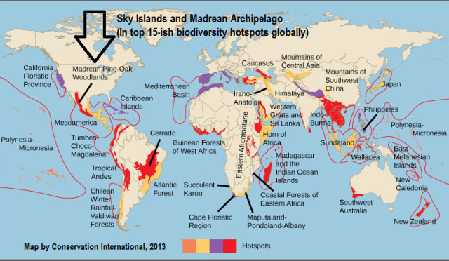
Even though chaparral of Mediterranean California and temperate rainforest of the Pacific Northwest are arguably 2 of the rarest and most distinct terrestrial biomes on the planet, the Sky Islands still function as one of the top 15-ish most notable biodiversity hotspots on the globe. Here, the Sky Islands are included in a wider ecoregion known as “Madrean pine-oak woodlands.”
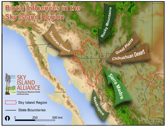
The Sky Islands region - at the heart of the “desert” region of North America - is arguably one of the most distinctive biodiversity hotspots on the continent:
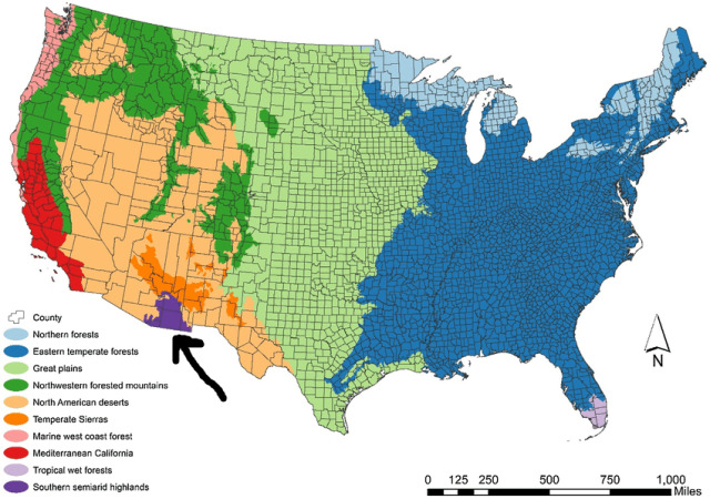
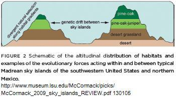
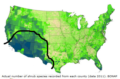
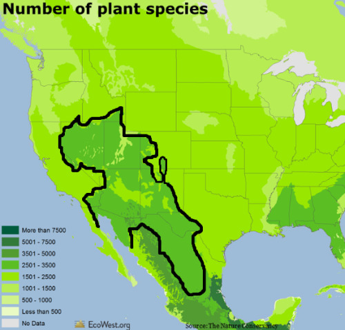
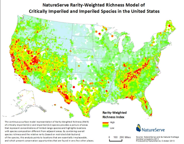
Endemic species …
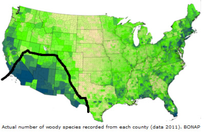
Some famous maps of distribution and concentration of endemic species in North America. [I actually have some disagreements with these maps, and how the researchers loosely defined the distinction between an “endemic species” and a “small-ranged species.” For example, the Pacific Northwest hosts more endemic amphibians than is displayed on the maps; the amphibians only live within the narrow marine-influenced coastal temperate rainforest zone, but since the zone stretches across latitudes between Vancouver Island and the Klamath Mountains, the animals aren’t considered “endemic” … even though they’re clearly endemic to PNW rainforest. But generally, I think they’re great resources and useful maps.]
The “cold deserts” of the northern Great Basin usually get even less attention and credit than hot deserts. But!